Inside the Theater
Any crisis, on real ground.
Six scenes recorded in the Theater. Each says in words what is real and what is invented.
Lower Manhattan in a grey storm: water rises over the Battery and the streets while a gauge climbs and labels mark flooded places. The surge is simulated.
Google Maps · Imagery ©Google and its data providers · Cesium ion · For promotional purposes only
Emergency management
Simulated · Theater capture, 30 Sep 2026
Lower Manhattan
A storm surge rises through real streets on a crisis clock. The surge and its gauge readings are invented.
A thermal-look 3D map of west London at night sweeps from camera to camera north of Heathrow, beside each real TfL traffic camera's recorded night feed. The search and the hit are an exercise.
Google Maps · Imagery ©Google and its data providers · Cesium ion · Traffic flow data © TomTom · Powered by TfL Open Data · For promotional purposes only
Counter-terrorism search
Simulated · TfL cameras and TomTom flow as received 01:21 BST, 29 Sep 2026
Heathrow's northern edge, London
A search sweeps real traffic cameras from the 3D map. The search and the plate hit are invented.
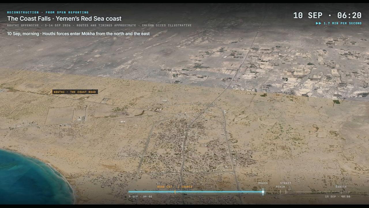
Yemen's Red Sea coast at Mokha on 10 September 2026: the day clock runs as the view swings over the town to its port and airport, and dated cards appear where reports placed them, each naming its source.
Google Maps · Imagery ©Google and its data providers · Cesium ion · For promotional purposes only
War rebuilt
Reconstructed · Theater capture, 29 Sep 2026
Mokha, Yemen, 10 Sep 2026
Mokha's fall, rebuilt on real ground from open reporting. Each card names its source.
Drones cross the shoreline toward a refinery district on the Houston Ship Channel, among ship tags and air traffic; one strikes a tank farm and the plume leans on the wind. The attack is simulated.
Google Maps · Imagery ©Google and its data providers · Cesium ion · For promotional purposes only
Homeland security
Simulated · ship, aircraft and wind data as received 28 Sep 2026
Houston Ship Channel
A drone attack on a refinery district, among real ship and air traffic. The attack is invented.
Ships: AIS via AISStream.io · Aircraft: ADS-B via The OpenSky Network · Wind: Open-Meteo.com
Over the Gulf of Aden toward Mukalla: two jets cross the coast, release, and the bombs fall on the port, raising columns of black smoke. A reconstruction from open sources, shown in daylight.
Google Maps · Imagery ©Google and its data providers · Cesium ion · For promotional purposes only
Air strike rebuilt
Reconstructed · Theater capture, 23 Oct 2026
Mukalla, Yemen, 30 Dec 2025
A strike on the port, rebuilt from open sources. Aircraft, bombs, route and hour are representative.
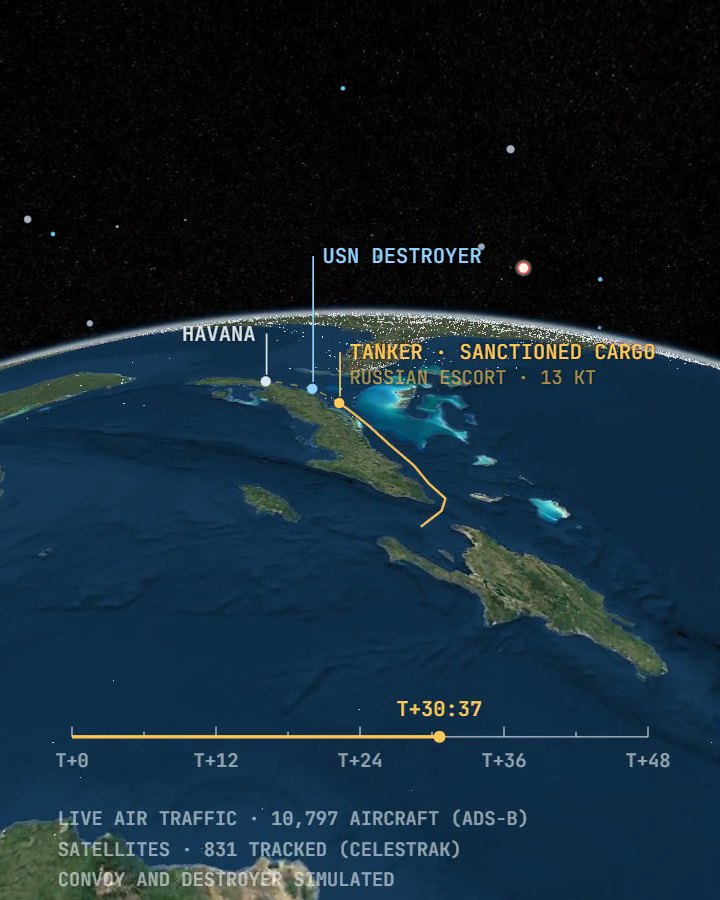
A black-and-white drone sensor view of Havana's harbour mouth: a tanker under the crosshair clears the channel past El Morro. The thermal look is drawn from the map, not sensed.
Google Maps · Imagery ©Google and its data providers · Cesium ion · For promotional purposes only
Maritime surveillance
Simulated · Theater capture, 30 Sep 2026
Havana harbour
A drone's sensor follows a tanker into a real harbour, in a drawn thermal look. The drone and the tanker are invented.




Open-source data
Real-time open-source data, in the scene.
The Theater draws these feeds as they arrive. The first screen, London and Houston show them in use; each recording says when its data was received.
- AircraftADS-B via The OpenSky Network
- ShipsAIS via AISStream.io
- SatellitesOrbits from CelesTrak
- City traffic camerasTfL JamCams
- Satellite imageryCopernicus Sentinel-2
- Weather and windOpen-Meteo
- Photoreal 3D globeGoogle, via Cesium ion
The AI voice agent
Ask the Theater out loud. It answers, and says what it cannot see.

The Theater's own screen: the globe turns to Yemen and an imaging watch over Mokha scrubs through a reconstructed night until a fan of sightlines marks the first satellite pass.
Powered by Esri · Cesium ion · Orbits: CelesTrak

The Theater's own screen: the view drops from orbit through a box on the strait into Sentinel-2B's real picture of Perim island on 11 September 2026.
Powered by Esri · Cesium ion · Orbits: CelesTrak · Contains modified Copernicus Sentinel data 2026
Powered by Esri · Cesium ion · Orbits: CelesTrak · Contains modified Copernicus Sentinel data 2026
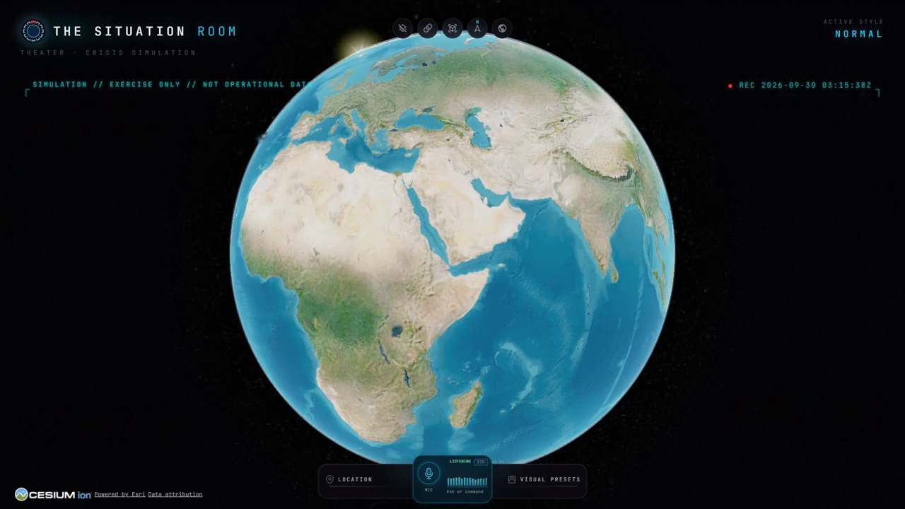
A recorded session on the Theater's screen, with sound: Control asks by voice which satellites could have seen Mokha the night it fell and Perim after the landing; the agent answers with reconstructed passes on real orbits, then shows Sentinel-2's real pictures of Perim. Control's voice is synthetic.
How a session runs
One big screen. Every role on its own phone. Control on the clock.
Every decision is sealed on the record.
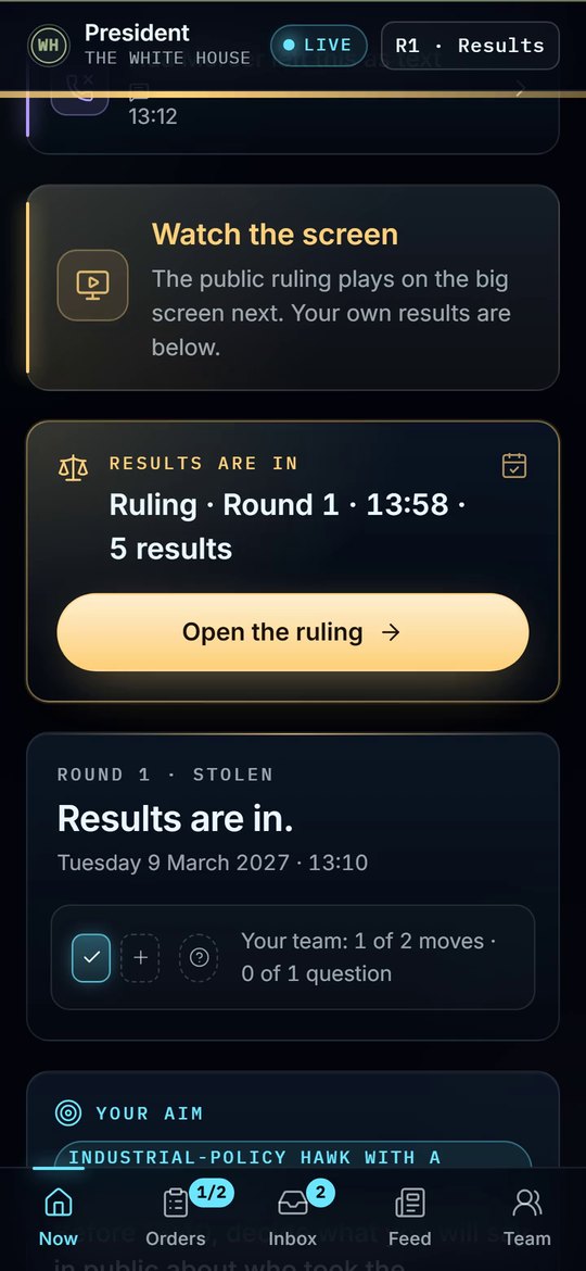
A test capture of the real seat app on a phone: the screen says to watch the big screen, then results are in and the round's ruling opens.
It has run
On 24 September 2026, twelve students at Columbia SIPA sat as a national security council for one afternoon. The Theater was not used that day.
- WHERE
- Columbia SIPA, New York
- WHEN
- 24 September 2026, one afternoon
- EXERCISE
- A national security council in an invented crisis
- SEATS
- Twelve students, each on their own phone
- PLAYED BY AI
- The counterparts, and the press corps at a live press conference
- NOT USED THAT DAY
- The Theater
No picture on this page was filmed that day. The phone screen above is a test capture of the real software on test data.
You cannot rehearse the crisis. You can rehearse the decision.
For policy schools, ministries, leadership teams, and defence and security educators.